
These days, it is anything but easy to think of our friends and colleagues in Sudan. After all, our working area in northern Sudan has seen the worst rainfall in decades and there is still no end to the war in sight. Nevertheless – inspired by the EAA last week in Rome and fully motivated by meetings there with colleagues who also work in Sudan – I was able to achieve great results regarding our survey in Attab West in the last few days. It was a kind of by-product of my preparation for the International Conference for Meroitic Studies next week in Münster.
Among other things, I will be talking about dry-stone walls in Münster – and that’s why I took another look at all our drone images and, above all, the georeferenced orthophotos and digital elevation models, especially from Attab West and Ginis West.
The level of detail in these photos and models is simply marvellous! And so I was finally able to correctly localise a site in Attab West that I had never actually found on site in Sudan! But that will be a topic for another time.
Today we want to focus on a detail about the New Kingdom settlement site 2-T-62. Vila describes it as a habitation site whose structures are spread over a series of small mounds that extend from east to west over 200 metres and a width of 50 metres, 175 metres from the Nile. The site also contains several dry-stone walls, although their dating is not certain.
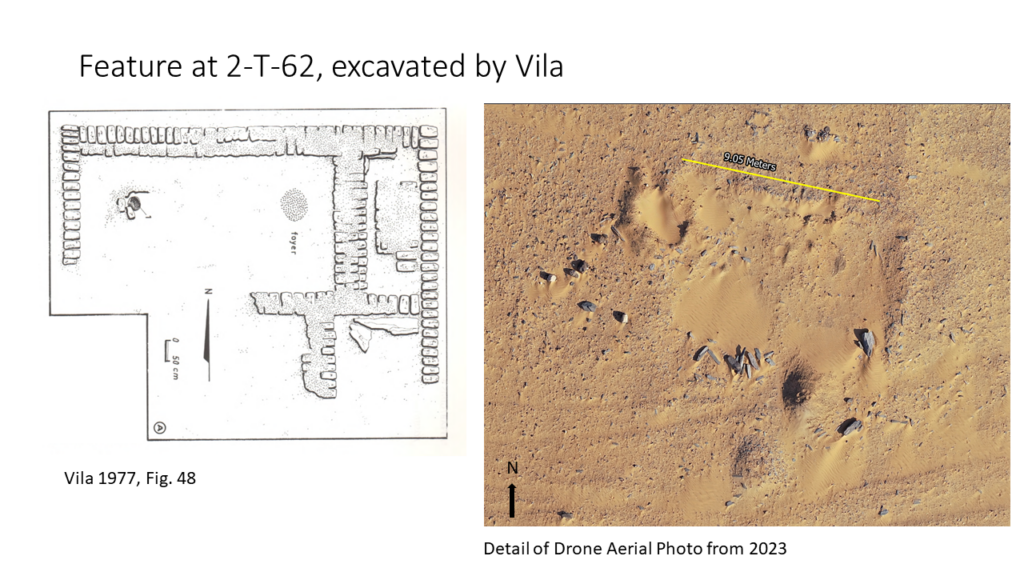
For a long time, we weren’t sure whether the site we excavated in 2022 and 2023, AtW 001, really belonged to the larger site 2-T-62 or not – but the answer is now a resounding yes. The special discovery this week, however, is that from my desk here in Munich, I have finally found the mudbrick building 2-T-62/1 that Vila excavated in the 1970s!
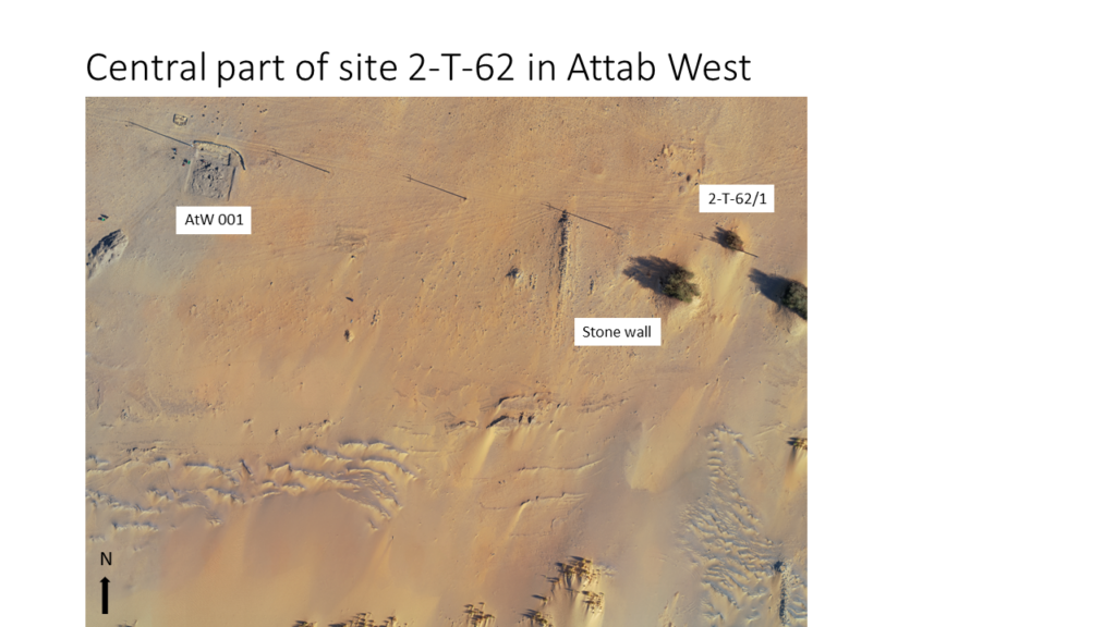
It was simply not recognisable on site – there were no more pottery sherds, other artefacts or mudbricks lying around. However, the dimensions can be easily checked on the orthophoto – they fit perfectly. Vila described 2-T-62/1 as a rectangular structure measuring 9 m x 7 m, orientated from east to west, of which only one layer of the foundation walls survives (Vila 1977, 88-89). Inside, a courtyard with a fireplace was identified in the north-west corner, bordered by rooms to the east and south. The room in the south-east corner contained the remains of a schist floor/pavement – something we know very well from the urban sites of Sai Island and Amara West. Some of the schist slabs can still be recognised on the orthophoto.
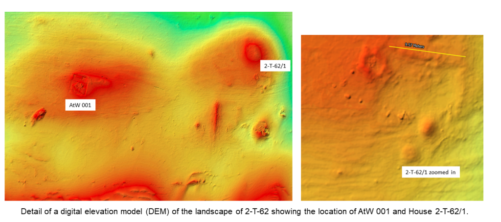
The digital elevation model also clearly shows the excavated building and the surrounding landscape. AtW 001 is located on a small mound to the west, the building 2-T-62/1 on another mound further to the east. A possible palaeochannel runs north of the two mounds from east to west (see Budka et al. 2023).
This successful remote sensing and the new results of 2-T-62 are comforting in several ways – on the one hand they clarify open questions and on the other hand they offer a very good opportunity to analyse our data even when we cannot be on site in Sudan.
References
Budka et al. 2023 = Budka, J., Rose, K. and C. Ward. Cultural diversity in the Bronze Age in the Attab to Ferka region: new results based on excavations in 2023. MittSAG – Der Antike Sudan 34, 2023: 19−35.
Vila 1977 = Vila, A. La prospection archéologique de la Vallée du Nil, au Sud de la Cataracte de Dal (Nubie Soudanaise). Fascicule 6: District de Attab (Est et Ouest). Paris 1977.