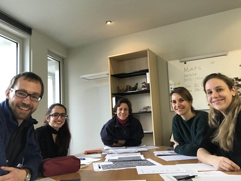
This week passed by very fast, the weekend is already approaching. Since half of the team left by now, we are working in a very small group these days. Huda, Jessica and me were busy at Ginis East, site GiE 001, where the surface is covered with primarily New Kingdom material.
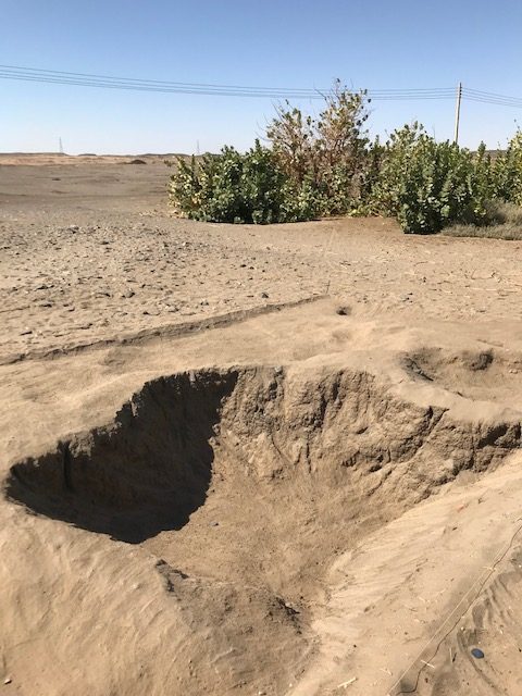
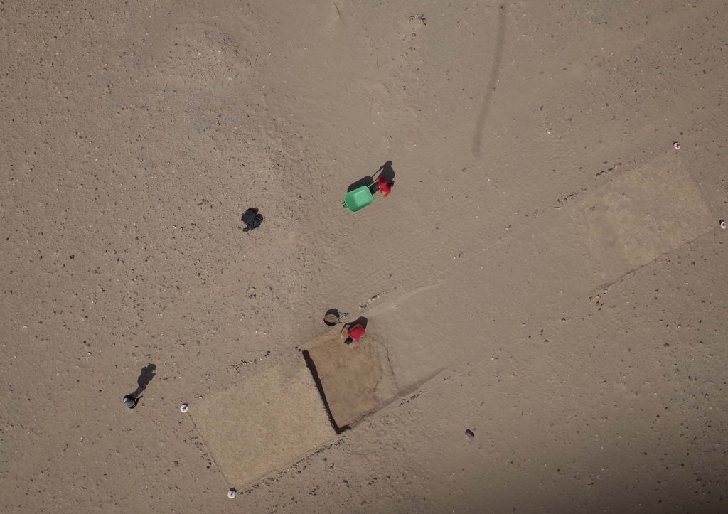
Today, we made much progress in Trench 2 – first of all, we are currently excavating marog pits. Marog corresponds to sebbakh digging in Egypt and refers to recent pits excavated in the soil/mud bricks to use the clay as fertilizer in the fields.
The largest of these pits in Trench 2 is 2.40 m in diameter and 75 cm deep. It was filled with fine sand and the traces of the tools the marog diggers used are clearly visible on the sloping edges. We documented everything in 3D according to our standard procedure.
We have
already much experience with these pits from Sai Island where they are also
common in the New Kingdom town area. The material within the pits is usually
very mixed – and this also holds true for GIE 001. Five baskets of pottery were
collected from Trench 2 so far and although the majority is clearly New Kindom,
including Ramesside material, there are also Napatan pottery and Christian
ceramics. And of course some recent material like date seeds were also found in
the filling of the pit.
Work will continue tomorrow, and since we have finished all the sandy fillings of the marog pits, we will now carry on with the muddy remains.
Since today
is a study day in the digging house to work on the finds from week 1 and 2, especially
pottery and lithics, I also have some time to give an update on our activities.
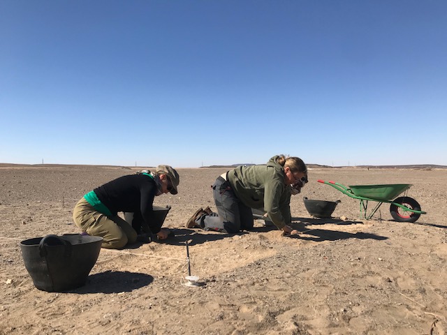
We concentrated on 3 sites in the area of Ginis East – all of them date back to the Kerma period, but especially at GiE 004 and GiE 005 there was also later activity based on surface finds and Christian ceramics.
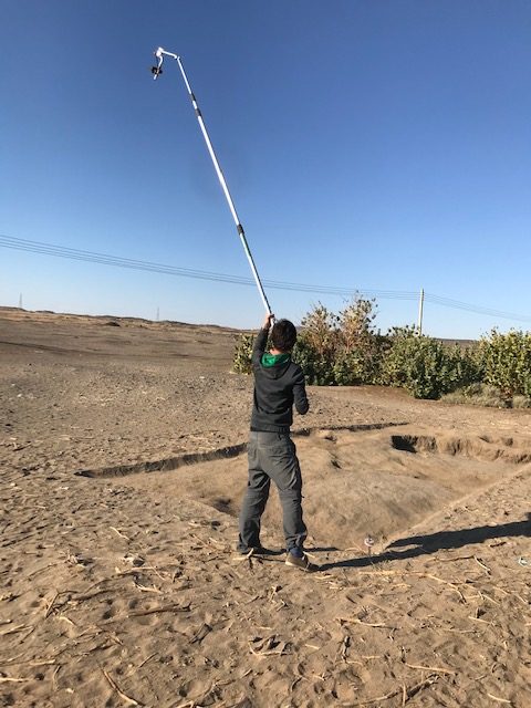
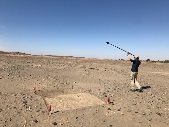
We only laid out test trenches this season since we wanted to check the common status of sedimentation and stratigraphy. And this turned out as quite disappointing – no stratigraphy was preserved in most cases, although two trenches yielded a few pottery sherds from a quite deep level. For all trenches, we used the same imaged based documentation system that we developed over the last years at Sai Island and it was very valuable to practice it in these new surroundings.
In addition, we got some very nice kite aerial photos from the sites.
Well, we will collect and analyse all these data further and despite of all, these are of course useful information for the general understanding of our concession area and the individual sites.
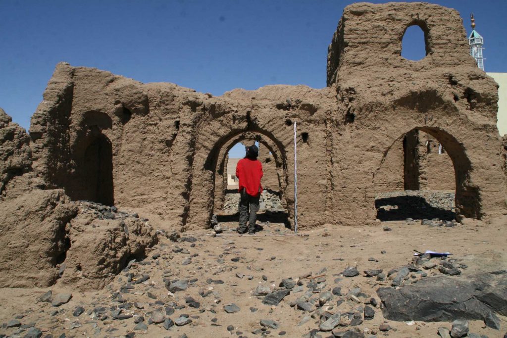
Another task this week was the small mud brick church at Mograkka (Vila site 3-L-2). Cajetan, Jessica and Huda spent an intense day there and re-mapped it. Our documentation includes a 3D structure from motion digital photographic documentation in combination with survey points from a total station. This is the first working step within a planned excavation and site management plan for this monument in the near future.
In the coming days, we will continue with test trenches at sites in Ginis East. This time with a very promising site where the surface is covered with loads of pottery from the Kerma period, the Egyptian New Kingdom and Napatan times. Keep your fingers crossed that there is some stratigraphy preserved!
Time flies
by, we have been very busy at several sites in Ginis East. Our technical
problems continued and the only solution was to cope with these and to learn
something for the future.
What
follows here could be classified under “fucked-up science” – things that go
wrong in science and are communicated and not covered up. I am a big fan of
this approach, especially on blogs and social media. However, I know that
critics always question this now quite fancy way of science communication as
being too simplistic, too self-focused and that it just serves for self-representation.
Well – granted that there are always two sides of a coin… But why I personally think
it is useful to incorporated “fucked up science” is first of all one aspect:
communicating failures and problems also tells people who are no insiders and
experts of the field, how many things must actually go right that we come up
with results and a nice documentation of archaeological sites. And how much can
go wrong… There are of course many errors, mistakes and new trials behind most
of scientific research – and in fields like archaeology, where we depend on a
large set of technical equipment, chances are very high to waste time and money
before all works out as planned… And thus, words like “waste of” and “failure”
do not always really fit, it is simply life with all its ups and downs and daily
challenges…
So let’s
start with an example from the current MUAFS season which is still full of
daily issues.
Our drone (property of my department at LMU) was stuck in customs since we arrived in Khartoum. Although our dear friend George from the Acropole Hotel did his best, gave almost daily updates, nothing changed and no clearance was issued. We finally decided to skip the procedure, abandon the efforts and to accept that we will not be able to conduct drone aerial photography like last year – after all, the only person with a proper license to use the drone is Cajetan. And Cajetan is already leaving Sudan in the next days. The drone now stays at the airport and will depart with me to Munich in March…
Here comes the lesson we learned: as fantastic, as it is to use a drone for aerial photography, in countries like Sudan their use comes with a number of complications and also of costs. We believe it is crucial to have an unsophisticated subsidiary at hand – like in our case the kite we already used for Sai Island in the framework of the ERC AcrossBorfders project. This kite I bought back in 2015 “lives” since than in Sudan, always stays here and last year I stored it in Ginis. Thus, it is always available, without electricity, without fancy equipment.
Of course, we did not cover the area we originally wanted to, as the kite has its limits compared to the drone – but it was a great joy to see that it works, that the surface models and photos themselves are really useful and of high quality. In Sai, we have experienced also days when kite aerial photography fails because of too strong wind, because there is not enough wind or due to the simple fact that the features we want to document are too close to the Nile (as Sai is an island) and would be too risky for the person holding the kite (and there are plenty of crocodiles around in the Nile…). So – there are of course situations when a kite in Sudan is not the best solution, we had been lucky in this respect this season.
To conclude, lesson 1 is: always have a Plan B for site documentation/aerial photography and keep this as much independent from external factors as possible. There were more lessons learned in this challenging season at Ginis, but these will follow in another post.
P.S.: network is really low these days, internet connection very slow so this blog must work for now without pics… But feel free to check my twitter account for some photos from the field!
Our second
MUAFS season started very promising and successful – we arrived as planned last
Wednesday in Ginis East and moved into a beautiful house we have rented for
this season.
On
Thursday, we set out our test trenches at the site of Ginis East 004, a Kerma
camp which was already recorded by Vila in the 1970s and where we made a magnetometer
survey last year.
The aim for this season is to check the stratigraphy of the site and especially to test whether the results of the magnetometry correspond to the actual archaeology.
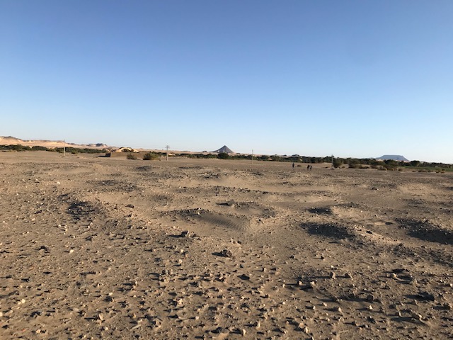
The general site of GiE 004, a Kerma village.
Three test trenches were laid out on Thursday and I started already surface cleaning in Trench 1 while the rest of the team was busy mapping and taking survey points. And here some of our problems started – our total station sent error messages and a big drawback was when we discovered on Friday that some of our benchmarks we set last year have been destroyed and are no longer usable… And our printer did not work anymore… To make things worse, I caught a food poisoning and had to go to the clinic in Abri for treatment. Thus, fieldwork at GiE 004 was stopped for the last 2 days. We hope to continue this afternoon since after hours and hours Cajetan seems to have solved the problem with the total station and I am more or less recovered.
Well – sometimes life as an archaeologist is really like a box of chocolate, full of surprises and not always of the sweet kind. As difficult as it is, we will try to stick with our schedule – hoping that we are now done with all the major problems of this season!
News about
proper fieldwork will therefore hopefully follow shortly…
We safely arrived in Khartoum Sunday night and we were really lucky this time, as we just left Munich before storm “Sabine” caused big problems for flights and other transportation. In the last two days here in Sudan, we were busy preparing everything for the second MUAFS seasons.
Quite a number of things have changed with the new government, with new regulations – there are still some pending Tasks for tonight but all in all, everything went well and we can stick to our time schedule and leave Khartoum tomorrow morning as planned.
Many thanks
go already to the National Corporation for Antiquities and Museums (NCAM) in
Sudan for all their support. Our NCAM inspector will be again our dear old
friend and colleague, Huda Magzoub, who worked with us already in the first
MUAFS season.
Looking very much forward to our travel to the beautiful area of northern Sudan and starting fieldwork in Ginis at a Kerma settlement site on Thursday! Given that our mobile connection allows it, we will of course keep you updated about our progress.
Time flies by, the winter term at LMU is in its final stage with exams approaching – and thus the next field season in the Attab to Ferka region in northern Sudan is getting closer.
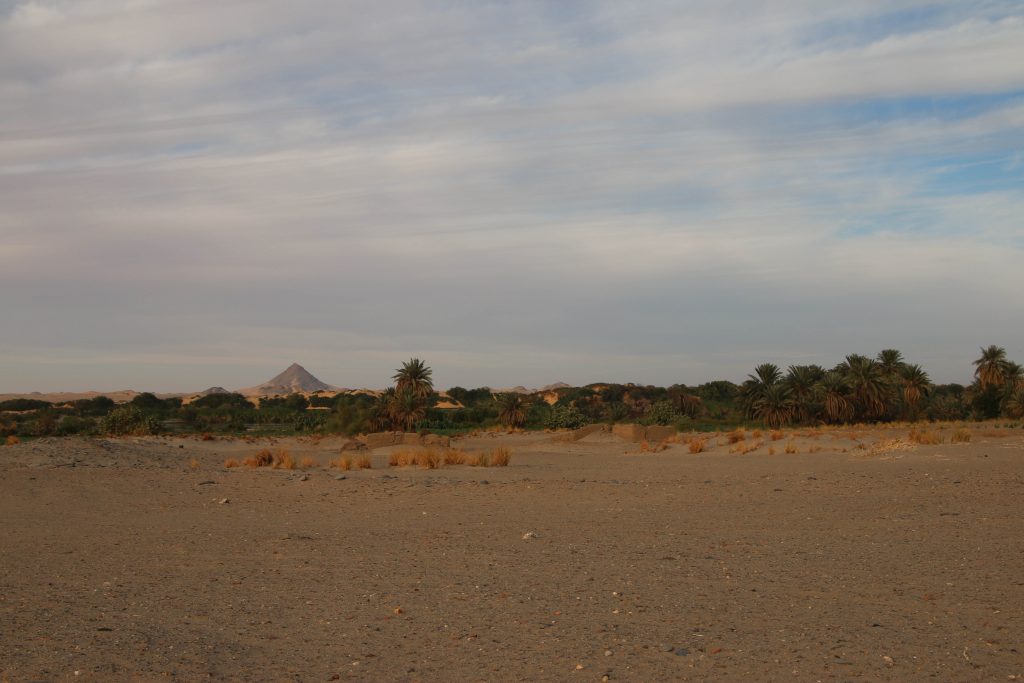
We will work 4 weeks in February/March with new headquarters in Ginis East, where there are multiple Bronze Age sites and a stunning landscape.
Landscape at Ginis East, looking northwest.
Today, we had a team meeting in the office, discussing the main aims and logistics for this season. As kind of prelude for the new ERC project DiverseNile, we will test a very promising Kerma site at Ginis East.
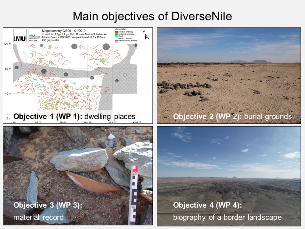
The principal goal of our first season is a test excavation at the site GiE 004. This site was documented by Andrè Vila in the 1970s (as site NF-36-M/2-T-5) and his work included some test trenches. We made a successful magneometry survey of this very intriguing Kerma village in 2019 and would now like to check the validity of our own results (created by Marion Scheiblecker). This Kerma settlement system comprises rounded huts and additional walls or fences; the southern part of the site, consisting of Kerma graves, is very recently destroyed. Rectangular as well as circular features are visible in the northern part of the investigated area showing negative magnetic anomalies. They could be caused by mudbrick with less magnetisable content than in the southern part, where the magnetic anomalies show high positive values indicating different building materials and/or sources. The borders of the wadi systems are clearly visible in the magnetogram of GiE 004; an excavation could proof if there was a kind of fortification along the wadi. This is the main aim for the 2020 excavation season.
Looking
much forward to our first season of excavation in the MUAFS concession – and of
course we will keep you posted!
I am both very
thankful and extremely proud to be one of the four
LMU scientists being awarded with an ERC
Consolidator Grant 2019, thus with the opportunity to conduct cutting-edge
research for 5 years with a budget of 2 million EUR. My second
ERC grant after a Starting Grant in 2012!
My project
is entitled “Cultural diversity in the Middle Nile Valley. Reconstructing
biographies in the periphery of urban centres in northern Sudan during the
Bronze Age” and has the acronym DiverseNile. Within the MUAFS concession, we
will be investigating the cultural contact between the various groups
inhabiting this part of the Nile valley and their relations with the intriguing
landscape of this region.
My goal is
to refine the cultural entanglement concept in New Kingdom Nubia with its
current elite and religious bias in favour of addressing actual cultural
diversity in peripheral zones. In order to
test my main hypothesis, I will develop a new concept, re-designing the concept
of contact spaces (Stockhammer/Athanassov 2018) in combination with the landscape
biography approach (Kolen/Renes
2015). This new concept of ‘contact space biography’
aims to investigate whether degrees of cultural diversity and entanglement
relate to the peripheral location of the sites, which may also be influenced by
the general landscape.
With our
new archaeological and scientific evidence we will move the current
understanding of Bronze Age Middle Nile groups to a new level, first of all
because of the combined assessment of villages and cemeteries. The novel
concept will also allow highlighting fluid perceptions of what was considered
as centre and as periphery.
The major goal of DiverseNile is to evaluate
the specific living conditions in the region between Attab to Ferka in direct
comparison with the urban centres of Amara West and Sai (see my ERC Starting
Grant project AcrossBorders https://acrossborders.oeaw.ac.at/ ), and to reconstruct biographies
based on material and textual evidence. My new cohesive approach considering
humans, non-humans, technologies and environmental properties in a peripheral
frontier region in northern Sudan has four main objectives and corresponding
work packages.
We hope
that our present comprehension of categorisations of ‘Nubian’ or ‘Egyptian’
sites will be significantly revised by this new method capitalising on the
concept of the dynamics of cultural encounters and add most important new
insights to the growing debate of how to understand ‘Nubian’ and ‘Egyptian’.The field-related outcome will thus be
a fresh understanding of processes currently labelled either as
‘Egyptianisation’ (with a one-dimensional perception of culture) or ‘cultural
entanglement’ (with an elite bias). Our bottom-up research will illustrate the
connectivity, complexity and social diversity within life worlds along the Nile
in the presently unidentified periphery of urban centres. Can’t wait to start
this exciting project!
Last but
definitely not least, I must thank all of those who supported my application in
various respects, from colleagues to friends, family and my partner. Foremost is,
however, the wonderful MUAFS team – such a huge project is only possible as
team work and I am very proud of my excellent team of researchers and graduate
students who contributed a lot to our joint success!
References
Stockhammer/Athanassov
2018 = Stockhammer,
P.W. and Athanassov, B. 2018. Conceptualising Contact Zones and Contact Spaces:
An Archaeological Perspective, 93‒112, in: S. Gimatzidis, M. Pieniążek and S. Mangaloğlu-Votruba (eds.), Archaeology
across Frontiers and Borderlands. Fragmentation and Connectivity in the North
Aegean and the Central Balkans from the Bronze Age to the Iron Age. OREA 9.
Vienna.
Kolen/Renes
2015 = Kolen, J. and Renes, J. 2015. Landscape Biographies: Key Issues, 21–47,
in: J. Kolen, H. Renes and R. Hermans (eds.), Landscape Biographies: Geographical, Historical and Archaeological
Perspectives on the Production and Transmission of Landscapes. Amsterdam.
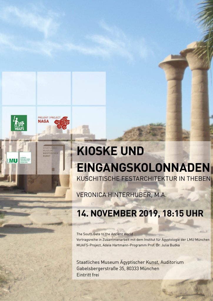
The winter term of LMU Munich is already quite advanced and there a number of lectures coming up, introducing special topics to experts, students and also the interested public.
Today, the MUAFS team member Veronica Hinterhuber will present her ongoing research on Kushite festival architecture in Thebes which is the subject of her PhD thesis at Humboldt-University Berlin.
As usual we offer free entry in order to advertise Sudan archaeology here in Munich, the venue is the Egyptian Museum as our cooperation partner in the lecture series „The South Gate to the Ancient World“.
Do not miss this chance to get an introduction into the intriguing building activities by Kushites kings like Taharqa at Karnak and Luxor, the centre of the Egyptian cult of Amun. Veronica will focus in particual on the function of the architecture built by the Twenty-fifth Dynasty in Thebes – important aspects which are both relevant for Egyptian and Kushite temple architecture.
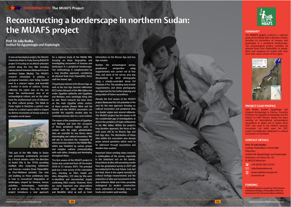
Perfect timing – summer term at LMU Munich has just ended, I am currently in Vienna, busy with preparing the next AcrossBorders volume to be published with the Austrian Science press, and a new dissemination article about the MUAFS project just appeared in the latest issue of The Project Repository Journal (July 2019, pp. 50-51) and is now live.
In this short article, freely available for download,
I tried to stress that the
MUAFS research concession is primary a geological boundary zone being located
next to a cataract region – the Second Cataract and especially the Dal Cataract
– , and secondly a frontier in terms of cultures. During millennia, the region
was on one hand the northernmost area of an archaeological culture, and on the
other hand the southernmost area of influence by other cultural groups. The
Attab to Ferka region is therefore a perfect case study for a contact space which is shaped by diverse encounters of human actors as
a complex social space.
We could confirm this rich potential with the results of our first field season back in December and January. The new approach of the MUAFS project to focus on cultural encounters and peripheral sites in a border region over several millennia will result in important new insights of this region of the Middle Nile Valley. With this new research concession, my team and I have the means to fill the considerable gap of investigations at sites in the periphery of major settlements in the Nile Valley. Within the MUAFS project’s long durée approach, the focus of the next years will be on Bronze Age and Iron Age sites. The distribution of these sites within the concession area already poses several questions which need to be addressed by means of excavations and detailed data analysis.
An update on our plans for the next field season in Sudan will follow shortly.
Within the
MUAFS concession, sites datable to the Meroitic Empire are rare and comprise primarily
tombs and cemeteries. Settlement sites in the region between Attab and Ferka
fall into other periods of Sudan’s history, including the Napatan Empire.
Towns and cities of the Kingdom of Meroe are well known from regions of the country further south – in particular within the island of Meroe, a semi-desert landscape between the Nile and Atbara rivers.
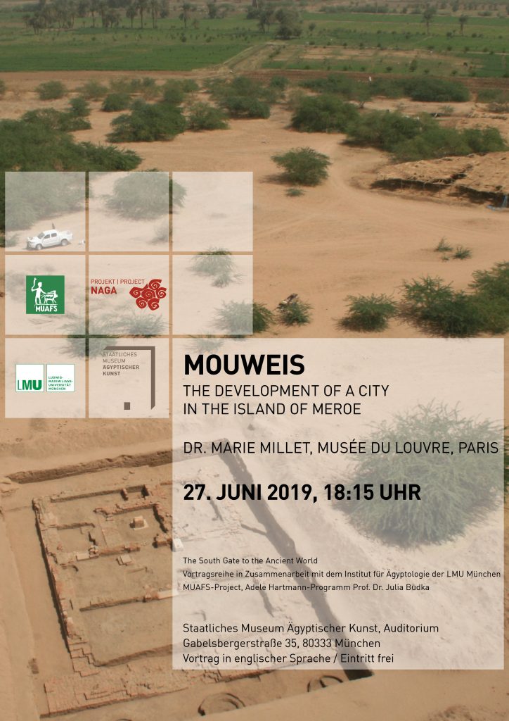
I am
delighted that one of the major Meroitic sites, Mouweis, will be the focus of this
week’s Sudan archaeology in Munich. Marie Millet from the Louvre Museum will
present the recent French excavations at this important city with temples, a palace
and production areas. Her research ties in perfectly with the archaeological
project of my neighbours here in Munich, the Staatliches
Museum für Ägyptische Kunst, and their excavations at the Meroitic site of
Naga.
Come and join us on June 27 for Marie Millet’s lecture highlightening recent advances on the archaeology and history of Meroitic Sudan!