Week 5 of our 2022 spring season is almost finished and we are getting ready to leave to Khartoum early next week.
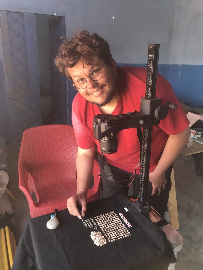
We made great progress processing and documenting our recent finds. Sawyer and I were busy with drawing pottery and small finds, Rennan took last photos (Fig. 1). A special focus was on the rich material from the Kerma cemetery GiE 003.
Fig. 1: Rennan was busy photographing beads and other objects from GiE 003.
Because of the large amounts of ceramics, I could spend less time than I hoped for the continuation of the survey. Nevertheless, I managed to document some nice sites in the close vicinity of our digging house. For example, I re-traced the site labelled by Vila as 2-T-23 in Ginis East. Here, dwellings and remains of four saqiyas of a Medieval village are situated on a length of 1500m in the alluvial plain, still partly preserved. Sherds are scattered around the site which is now in parts covered by modern fields and has suffered from some destruction by car tracks.
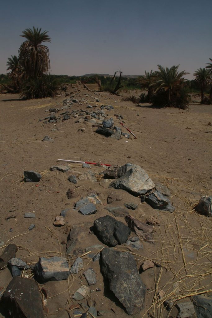
One of the saqiya Vila documented in the 1970s is especially well preserved (Fig. 2). Recording this site was extremely pleasant because the setting close to the Nile is simply beautiful. One just needs to avoid the early morning hours – since it is hot, the nimiti flies are quite numerous at this time of the day.
Fig. 2: One of the stone-built saqiyas of site 2-T-23.
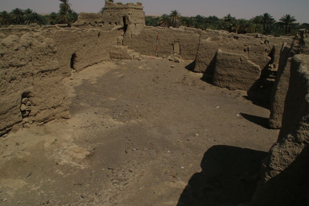
Yesterday, I covered another stretch of the east bank of the MUAFS concession and went to its very south-western part in Attab East. Here, the most spectacular monument is the extremely well preserved Islamic fortress Kourfa Hemmet, 2-T-57 (Fig. 3), which is surrounded by some Late Medieval remains. In this part of Attab, the Nile is very close to the sites, with a narrow strip of fields and one can already make out the Amara cataract in the water.
Fig. 3: View of the inner courtyard of the islamic fortress 2-T-57.
All these important monuments in a beautiful setting underline the general richness of archaeological sites in the MUAFS concession – and luckily we still have a few more days left in this gorgeous and peaceful part of northern Sudan!
While the first weeks of our 2022 season focused on mortuary remains and excavations in cemeteries, first of all the Kerma cemetery GiE 003, we switched focus and location in our week 4.
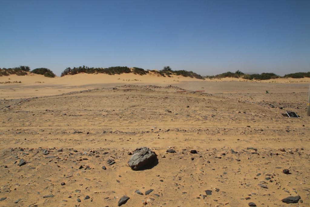
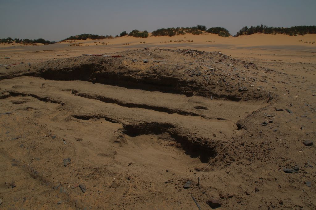
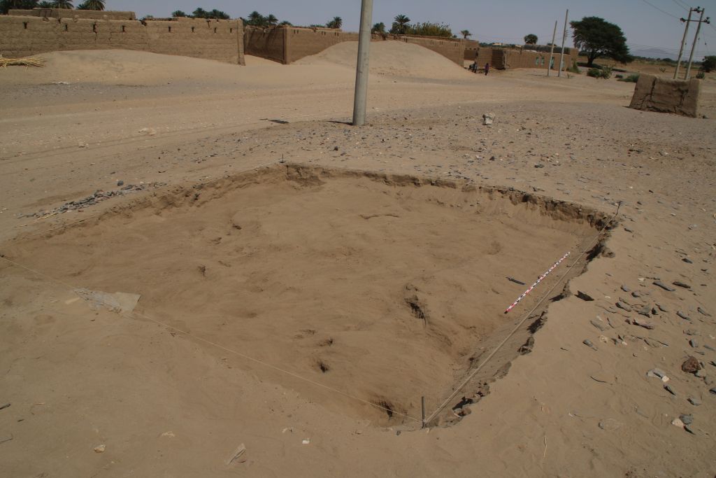
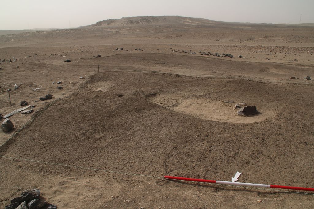
Earlier this year during our MUAFS survey, I noted an extremely interesting site at Attab West, with loads of early 18th Dynasty potsherds as well as scatters of local schist pieces on the surface. This site, AtW 001, is a small almost circular mound (Fig. 1). Unfortunately, the new line of electricity runs right through the site and seems to have destroyed part of it. This week, we went back there and excavated one trench as a first check of whether stratigraphy is preserved and any structures are traceable.
Fig. 1: Work in Week 4 focused on site AtW 001 at Attab West. View of Trench 1 to the south, with the loose surface removed. The mound covered with potsherds and schist pieces on the surface is still visible in the back.
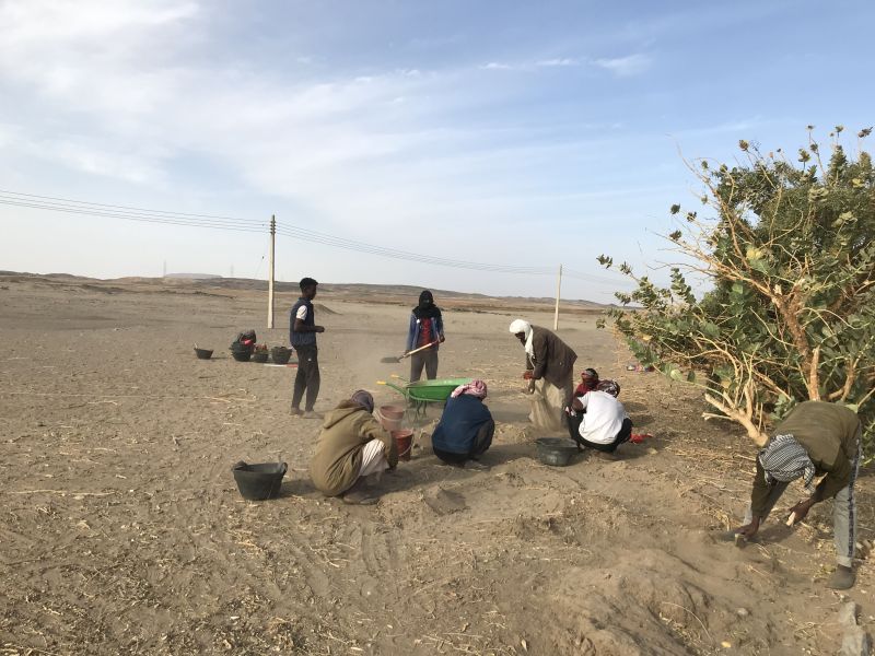
It was our first excavation on the west bank, which differs considerably from the east bank in terms of landscape and general conditions. Logistics are a bit more complicated as well, bringing the team and the equipment to the site by boat and through large sandy dunes with picturesque tamarisks.
In sum, the test excavation at AtW 001 was a challenge but also very rewarding – we found what can be classified as domestic rubbish, loads of ashy deposits, plant remains, animal bones and lots of pottery sherds as well as debris from fires and other everyday activities. The ceramics are nicely datable to the early 18th Dynasty to Thutmoside times. Interestingly, the amount of Nubian wares in the various horizons of fill was really high, accounting to ca. 30% of the ceramics. The lower fills only had very little ceramics inside and here the Nubian wares were more common than Egyptian style wheelmade pots – this is just a first impression and I will follow up on this with a more detailed assessment soon!
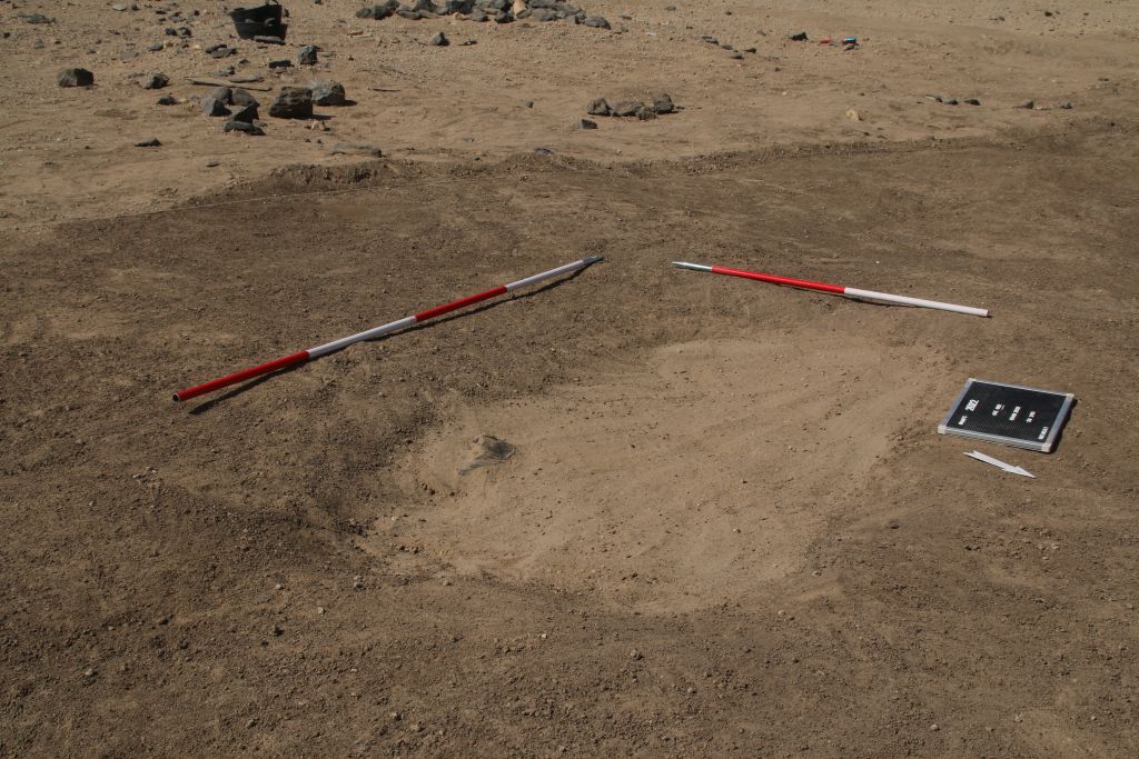
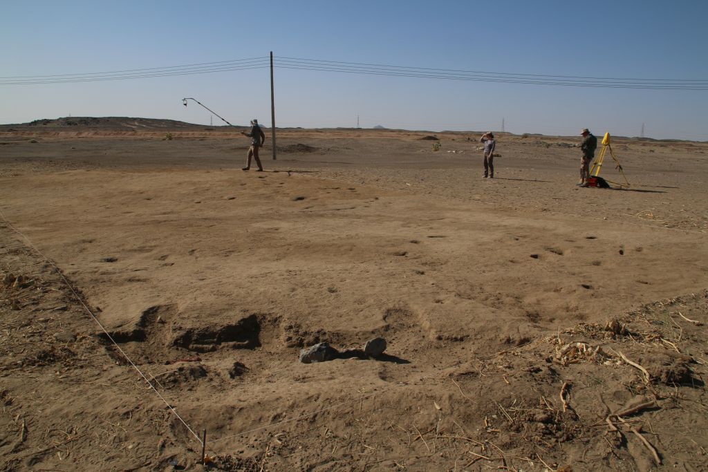
We seem to have at least two phases of activity in the New Kingdom period preserved, possibly an early phase and a slightly later one which can be dated to Thutmose III. Remains of collapsed mud bricks and overfired sherds indicate the former existence of buildings and possible also ovens or kilns, but no standing remains of architecture was identified up to now. There were several homogenous deposits of silt, partly showing some ash. The ashy spots of the earliest phase are directly on top of the natural alluvium, suggesting that we either have an open courtyard or maybe part of the periphery of a domestic site. Apart from ceramics, the finds included some grindstones and stone tools like pounders, testifying to some grinding and crushing activities. However, many questions about this site are still open and AtW 001 needs to be excavated on larger scale in the near future.
Fig. 2: Final status of Trench 1 at AtW 001 in 2022 – there is still much work waiting for us at this domestic site!
Overall, our site finds a perfect parallel in the nearby site 2-R-18 in the desert hinterland of Amara West (Stevens and Garnett 2017, previously documented by Vila in the 1970s). As highlighted by Anna Stevens and Anna Garnett, there were also rubbish deposits above homogenous deposits of silt and ash, which seem to have accumulated directly on top of the natural surface. Similar to our site, no traces of architecture were preserved at 2-R-18. The material culture, especially of the pottery and the stone tools, is extremely well comparable to our finds. The dating to the early 18th Dynasty is also almost identical.
Thus, the results of our trench are clearly promising and work at AtW 001 will continue in the near future. Especially the function and duration of use of this site will make a considerable impact to our aims of addressing seasonal sites as well as sites connected with gold working (as suggested by Stevens and Garnett 2017 for 2-R-18 and other desert hinterland sites) and other activities in the 18th Dynasty periphery of Sai Island.
With the final day of work at AtW 001 yesterday, our fieldwork with workmen and excavation has come to an end – just in time before Ramadan starts tomorrow. Part of the team – all of them fully recovered from the corona infection by now – has already left and is heading back to Vienna and Munich. A small team will continue with processing finds here at Ginis and documenting the rich material culture from our very successful excavations in 2022.
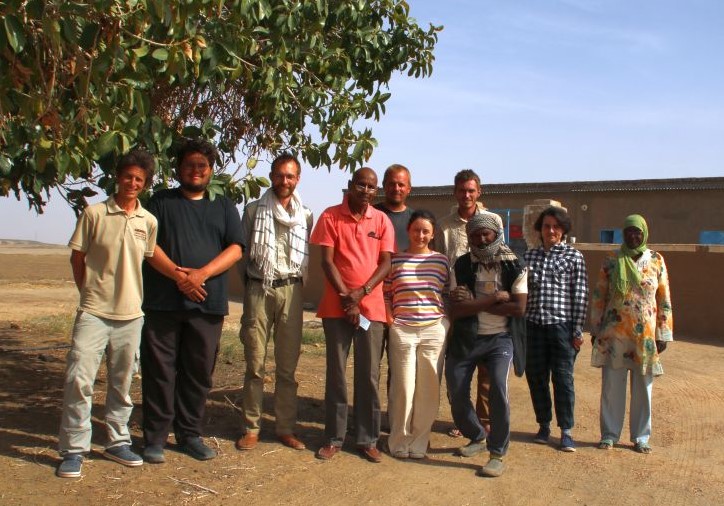
Fig. 3: Group picture of the DiverseNile 2022 fieldwork team.
Many thanks go to all team members of 2022 – it has been a challenging season with so much wind, cold weather, covid-19 and a dense excavation programme at four different sites. The results are clearly remarkable and I am very grateful to all! For now, I am really keen to process the new material in more detail in the upcoming week.
Reference
Stevens and Garnett 2017 = Stevens, A. and Garnett, A. 2017. Surveying the pharaonic desert hinterland of Amara West, 287‒306, in: N. Spencer, A. Stevens and M. Binder (eds.), Nubia in the New Kingdom. Lived Experience, Pharaonic Control and Indigenous Traditions. British Museum Publications on Egypt and Sudan 3. Leuven.
After a very exhausting week 2, we started with really bad news into week 3 – half of the team tested positive for the corona virus… Fortunately, all are getting better and only have mild symptoms, but this unpleasant infection in the digging house changed our entire daily routine and of course had an impact on the work in the field. Only four of us tested negative and could carry out the excavations tasks.
On the bright side, despite of our sudden reduction of people working in the field and again strong winds, we managed to finish both GiE 002 (the Prenapatan/Napatan cemetery) and also GiE 003 (the Kerma cemetery) this week.
*NB: Since we are excavating cemeteries, this blog post contains pictures of human remains.
At Trench 4 in GiE 002, I had another well-preserved burial in extended position in the southern niche of the tomb. It was partly moved during the looting in antiquity but is otherwise complete. With remains of mud bricks which were formerly blocking the niche (Fig. 1), this tomb finds close parallels in Missimina (Vila xxx), also as far as the material culture is concerned.
Fig. 1: A view of the burial within the niche of the tomb in Trench 4.
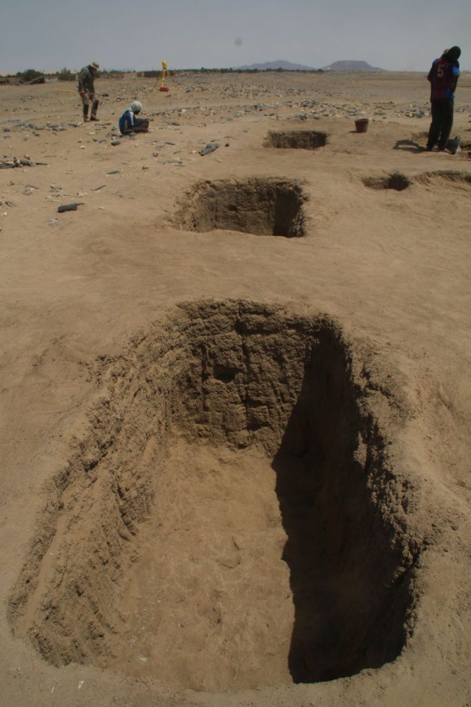
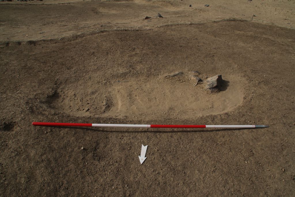
The Kerma cemetery GiE 003 situated between Attab and Ginis East really turned out to be worth all of our efforts. Despite of ancient looting, some of the Kerma burials were nicely preserved and some finds were left in place for us. Furthermore, dating the cemetery and a certain spatial development became possible. With our Trench 2 in the southern part of the cemetery, we cleaned part of the cemetery which shows large circular pits of the Middle Kerma period (Fig. 2). In Trench 1 further north, we had mostly rectangular pits, all with depressions on the east and west end, which can be nicely dated to the Classical Kerma period (Fig. 3).
Fig. 2: Our inspector Huda excavating animal bones in one of the Middle Kerma graves.Fig. 3: View of some of the excavated graves in Trench 1 datable to the Classical Kerma period.
In general, GiE 003 finds a very close parallel in the cemetery of Ukma in the Second Cataract region (Vila 1987). At our sites, the wooden funerary beds are not as nicely preserved and the burials more disturbed, but the pottery is very similar as are pieces of jewelry like beads and other objects. Some complete pottery vessels were found in GiE 003 and others can still be large reconstructed from fragments. One of the highlights from a Classical Kerma burial was a 15th Dynasty scarab with a royal name and this important piece will be presented in a separate blog post.
All in all, I am more than happy with the results this week and just wish that all of us can work again soon as the complete team – catching the Covid19 virus is never a good thing but getting infected while on excavation in the field in Sudan is really bad timing. Especially since our last week of excavation is approaching. Please keep your fingers crossed, we will keep you posted.
References
Vila 1980 = A. Vila, La prospection archéologique de la Vallée du Nil, au Sud de la Cataracte de Dal (Nubie Soudanaise). Fascicule 12: La nécropole de Missiminia. I. Les sépultures napatéennes. Paris 1980.
Vila 1987 = A. Vila, Le cimetière Kermaique d’Ukma Ouest. Paris.
This week was as the last ended – we had very strong winds, 3 days in a row with too much sand and dust in the air to excavate in open areas. The only place I could continue to work was the tomb in Trench 4 in GiE 002.
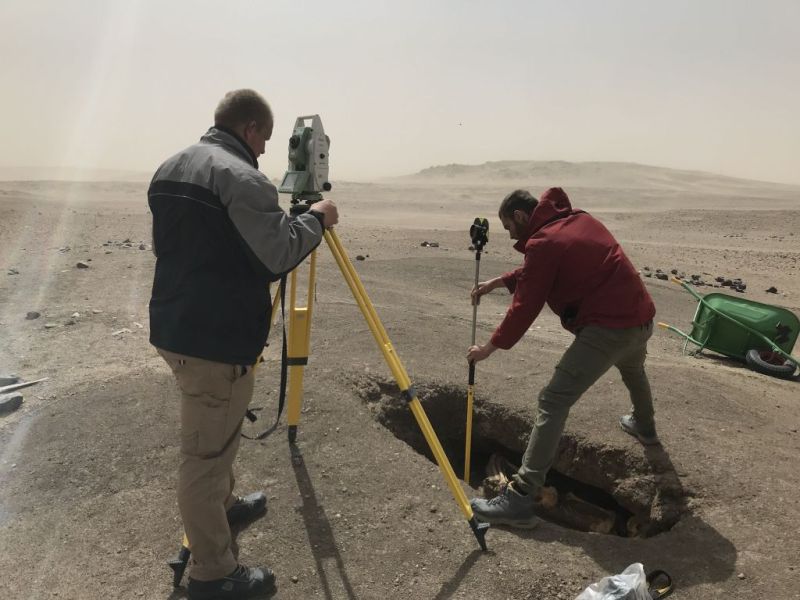
However, photographing, surveying and measuring under these conditions were really a challenge and Fabian and Max managed all what was possible (Fig. 1).
Fig. 1: Measuring outlines of stratigraphical units in the tomb at GiE 002 during heavy wind was anything else than easy or pleasant.
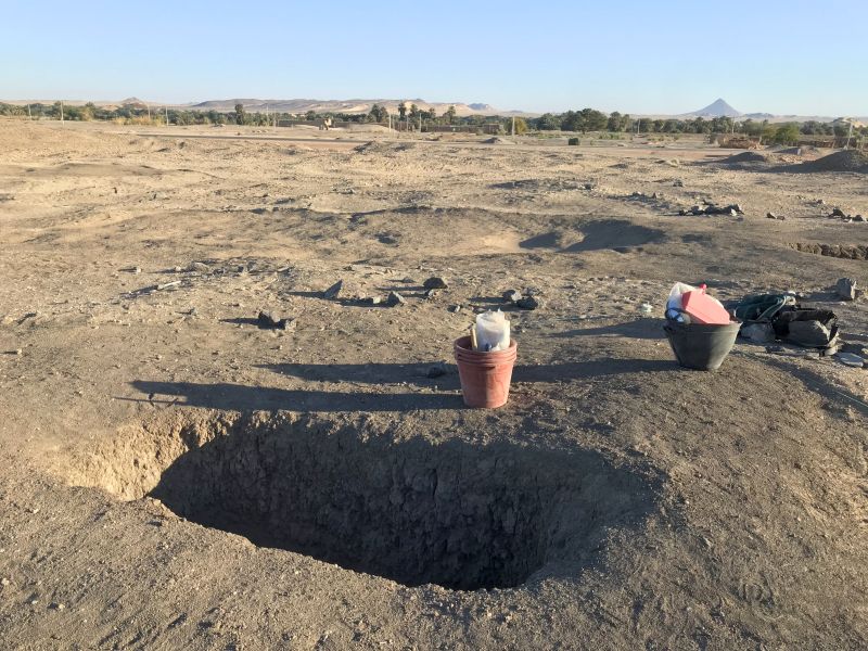
The results in this tomb (Fig. 2) are really amazing – we have found seven individuals so far and maybe more are to come!
Fig. 2: I hope to finally finish excavating this really intriguing tomb at GiE 002 in the upcoming days.
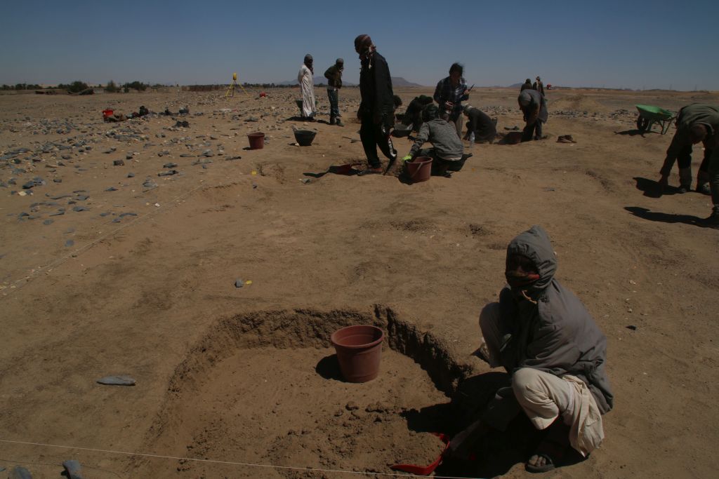
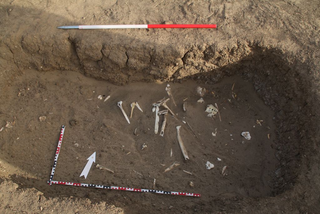
Originally, week 2 of our spring season was supposed to focus on excavation in GIE 003, a large Kerma cemetery at Attab/Ginis East. Here, we opened two trenches. In both of them, we found several burial pits and features filled with sand and human bones just below the surface, originally covered by tumulus superstructures. Excavation of these pits started on Thursday (Fig. 3) and although all is plundered, the material culture is really illustrative – high quality Kerma Classique ceramic vessels, Egyptian Marl clay vessels and some various types of beads as well as a pendant made of a mollusc. We are all very much looking forward to the next week!
Fig. 3: Excavations at the Kerma cemetery are now finally progressing fine!
In week 2, we were joined by late-comers from Munich and the 2022 field team is now complete: Together with Iulia, Sawyer helps with various tasks in the field and both of our student assistants were also drawing pottery during the very windy days; Rennan is excavating in the Kerma cemetery and Cajetan is using our drone for making aerial photographs.
Internet connection was and still is really unstable here at Ginis and more than updates on our weekend is difficult – so I hope to get your again interested next Friday!
Week 2 was very dense – we had strong winds on several days, even had to stop work on Monday and Tuesday. While the team and the workmen moved on Sunday to Kerma cemetery GiE 003, I was staying with two workmen at one of the tombs we found at GiE 002.
* Please note: since we are excavating tombs, this blog post includes pictures of human remains.
The first tomb we found in Trench 1 was just a simple pit burial of probably Prenapatan or Napatan date. A minimum of 2 adult burials was found, but all mixed and displaced.
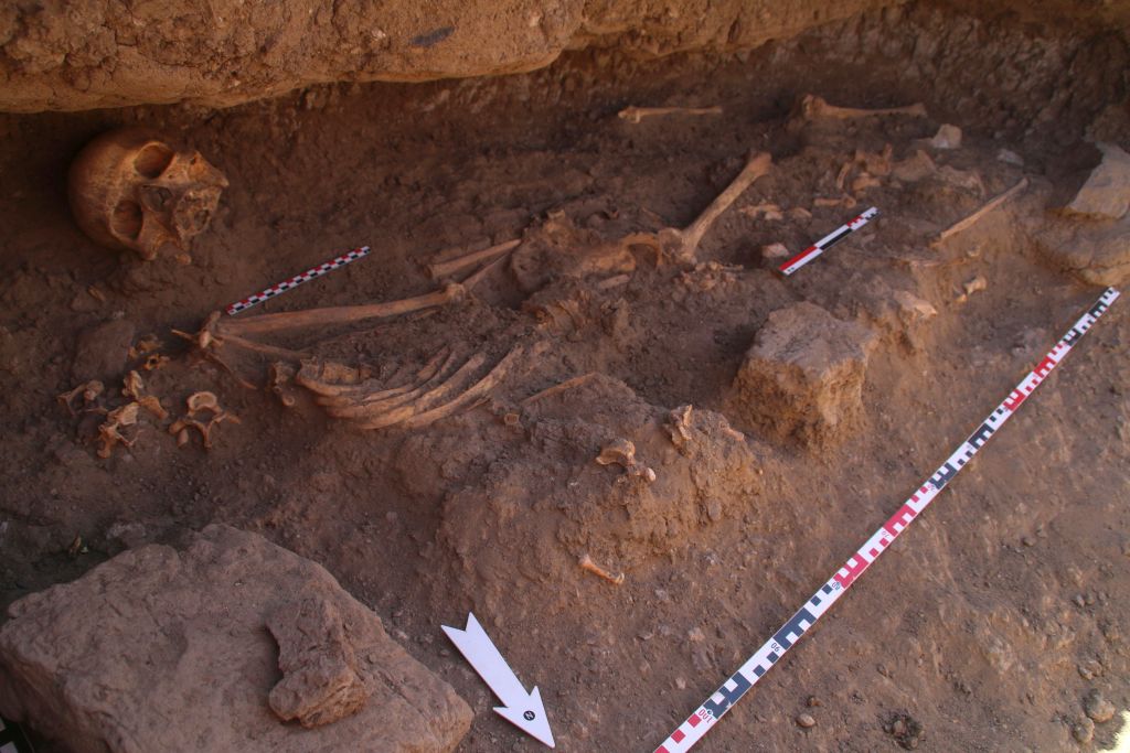
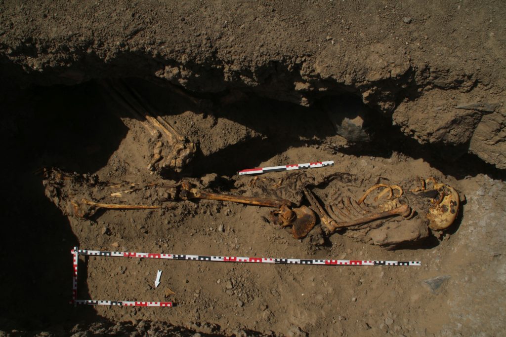
The other tomb in Trench 4 (Fig. 1) was really quite surprising: an intact burial, wrapped in textiles from the head to the feet was found in an extended sidewards position in the sandy filling (Fig. 2). A few mud bricks were found along the body, the back part of the neck was resting on a large mud brick. This female burial seems to date from Medieval times (a completely wrapped body of this period was found by Vila in a cemetery nearby in Ginis, at 3-P-37, see Vila 1977: 98-101, Fig. 44) and is of intrusive character.
Fig. 1 – The tomb in Trench 4 with the outline of the pit and its sandy filling.Fig. 2 – The intrusive (seemingly Medieval) burial in the pit.
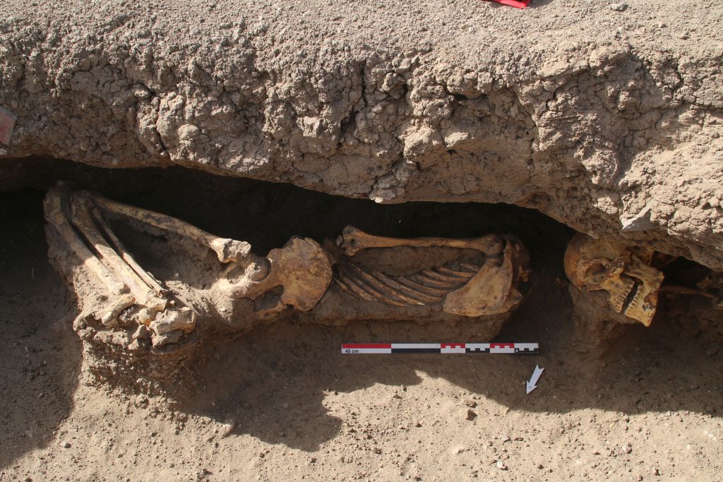
The same holds true for two (or maybe even three) individuals discovered slightly above the Medieval burial in the side niche of the tomb. One well preserved burial in a contracted position and one skull with remains of the shoulders was unearthed (Fig. 3). Another skull probably belongs to the contracted burial, but was slightly displaced. This requires an expert check by a physical anthropologist.
Fig. 3 – The contracted burial and another intrusive skull in the side niche.
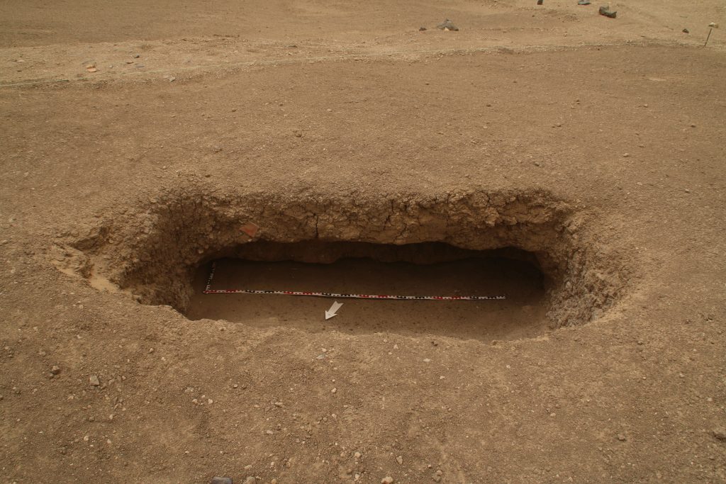
Apart from some Prenapatan (or maybe Napatan) sherds in the filling, no finds were made so far. My assumption is that the niche will continue as a proper side chamber to the south (see Fig. 4) and that we will find remains of the original burials in a lower depth. Let’s see if this expectation comes true! Already now, our findings in GiE 002 differ from the results by Vila and suggest a very interesting long use-life of this cemetery with multiple burials from various periods.
Fig. 4 – The status of the tomb with the upper burials removed – the side niche seems to continue towards the south.
Reference
Vila 1977 = A. Vila, La prospection archéologique de la Vallée du Nil, au Sud de la Cataracte de Dal (Nubie Soudanaise). Fascicule 5: Le district de Ginis, Est et Ouest. Paris 1977.
We had an early and unpleasant start into the weekend – because of a strong sandstorm we needed to stop work at Thursday already before breakfast. Since we were just cleaning the human remains in the first tomb we found at GiE 002 and discovered a second pit burial, this was indeed unfortunate.
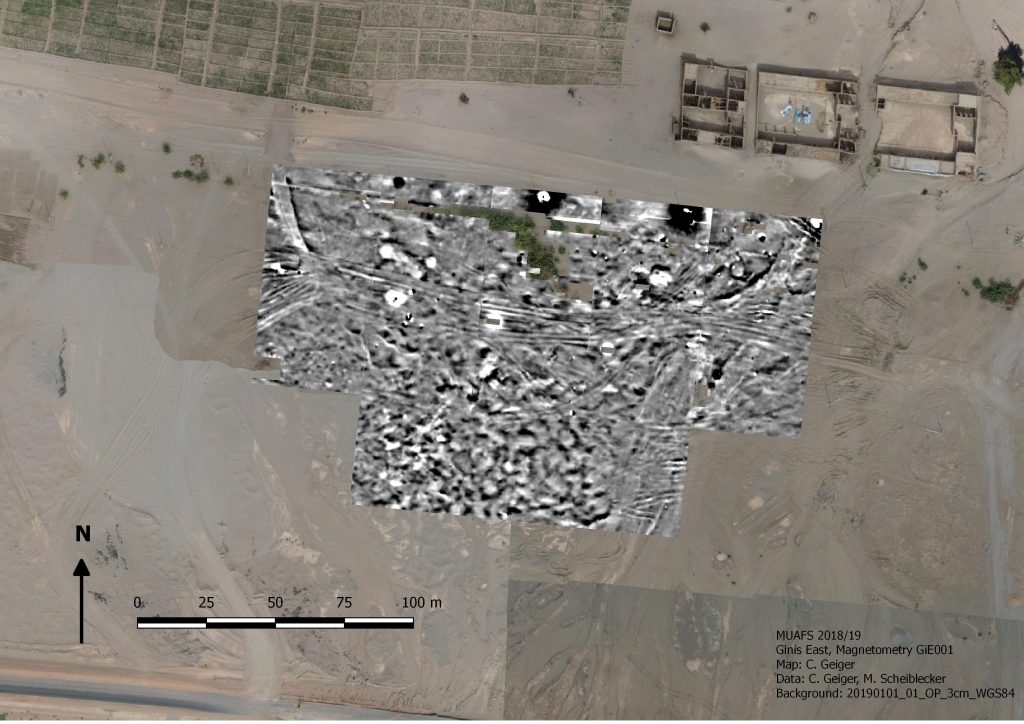
However, the first week of our 2022 was intense and in many respects successful. Part of this success might not seem very positive at the first glance, but is nevertheless of much relevance for the project. We stopped work at the settlement site GiE 001 already after 4 days. We did not succeeded in finding archaeological features at this site, but we confirmed my earlier impression about this site based on the results from the two test trenches we opened in 2020 (Trench 1 and 2`, Budka 2020, 66-67). With one large area (Fig. 1) and one small test trench (Fig. 2) we now know for sure that a thin sandy surface layer with finds from various periods – Kerma, 18th Dynasty, Ramesside, Napatan and Medieval – is directly on top of natural alluvial layers. No archaeological stratigraphy or sediments are preserved. Our magnetometry from 2018/2019 does not show any archaeological features but simply differences in the soil (e.g. sandy areas).
Fig. 1: Trench 3 at GiE 001 which did not yield any archaeological layers other than the top soil mixed with finds.Fig. 2: Trench 4 where the natural surface was just covered by a sandy top layer comprising much pottery and stone tools (mixed date).
With this confirmed, we moved on Wednesday to cemetery GIE 002 just a bit further south. Here, the main aim was finding some tombs to check the dating as proposed by Vila in the 1970s. He dated the small cemetery with largely dismantled stone superstructures to the New Kingdom, but already the one pit burial he excavated and its pottery vessels suggest that this is too early. A Pre-Napatan or Napatan dating would clearly fit much better.
This is now getting more and more likely after just 1.5 days of work – we discovered two tombs of the pit burial type as described by Vila (site 2-T-13) and all of the associated ceramics seem to postdate the New Kingdom.
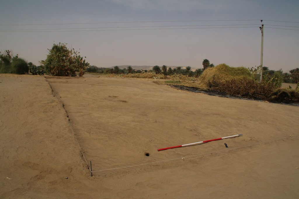
First, we opened a large area where we thought depressions of three tombs are visible on the surface (and on the magnetometry, Fig. 3). The result was a bit surprising, only one tomb in the eastern part was found (Fig. 4).
Fig. 3: Location of Trench 1 at GiE 002.Fig. 4: the burial pit in Trench 1 found refilled by windblown sand.
In the sandy filling of this burial pit, we have a minimum of one adult burial in displaced position (Fig. 5). Because of the sandstorm, we did not yet finish excavations and still need to clean the pit. Since Vila found the remains of seven individuals in a similar burial pit (Vila 1977, 48, fig. 16), I expect more human remains closer to the bottom.
Fig. 5: the pit burial yielded displaced human remains within the sandy filling.
Two other areas in GiE 002 yielded no burials at all, but Trench 4 finally comprised another pit burial filled with windblown sand (Fig. 6). We also started work in another area (Trench 5) but had to stop there because of the storm. Thus, with a minimum of two pit burials to be excavated we will be able to reassess this site – please keep your fingers crossed that the tombs also include some diagnostic pottery!
Fig. 6: the newly discovered burial pit before we needed to stop because of the storm.
In our first week, the division of work within the team worked out perfectly. Max and Fabian from Novetus were documenting all trenches at GiE 001 and GiE 002, Iulia was responsible for writing find labels and the consecutive find list. Our inspector Huda helped with supervising the workmen and our driver Imad was helpful in many respects. All of them, our wonderful gang of Sudanese workmen included, did a great job and I am very much looking forward to the results of the upcoming week.
References
Budka 2020 =J. Budka, Kerma presence at Ginis East: the 2020 season of the Munich University Attab to Ferka Survey Project, Sudan & Nubia 24, 2020, 57-71.
Vila 1977 = A. Vila, La prospection archéologique de la Vallée du Nil, au Sud de la Cataracte de Dal (Nubie Soudanaise). Fascicule 5: Le district de Ginis, Est et Ouest. Paris 1977.
Time flies by, especially in the field. We have been really busy since our arrival at Ginis on Thursday. Apart from logistics and last constructions in the new digging house, we prepared the start of fieldwork at the New Kingdom site of GiE 001. I am delighted that new team members have arrived at Ginis: This season, the LMU DiverseNile team is strengthened by two employees of Novetus (Vienna). Maximilian Bergner and Fabian Spitaler are both experienced field archaeologists and responsible for the excavation work and field documentation in this 2022 season.
On Saturday, we opened a large new trench and started excavations with a team of local workmen. We placed the trench based on the results from the magnetometer survey in 2018/2019 and of course the local topography.
Start of work at Trench 3 on Saturday.
On our second day, we are currently still removing surface layers of sand and soft mud levels – the area used to be a favourite resting place for one of the sheep herds of Ginis (and the animals still have plenty opportunities just a bit further to the east and fortunately quickly adapted to this change in their daily routine). This is evident by many droppings and darkened spots on the surface.
Most of the trench is covered by loose sand below the uppermost surface (photo: I. Comsa).Imaged based documentation of the individual stratigraphical units in the new trench.
Nevertheless, already in the uppermost layers we are finding plenty of New Kingdom pottery. I processed the first baskets from these layers this afternoon. Interestingly, some contexts produced more Nubian style pottery than Egyptian style pottery – maybe this is just accidental, but the occurrence of Black-Topped Kerma style wares as well as impressed and incised decorated Nubian wares and basketry impressed cooking pots are intriguing. As documented earlier, I am also stunned by the fact that both 18th Dynasty and Ramesside pottery is present, suggesting a long period of use of this settlement.
Work will continue tomorrow and we will try to keep you posted – internet connection is very unstable at our digging house in Ginis, but the connection in the town of Abri allows me to upload small data like this blog post.
After some really busy and intense weeks, I finally made it back to Sudan. Iulia and I arrived yesterday night. Everything is sorted and we are ready to leave Khartoum to the north tomorrow morning with our friend and colleague Huda as our NCAM inspector – to start our first proper excavation season for the ERC DiverseNile project.
This spring season is super exciting: we will excavate several New Kingdom sites at Ginis East, hopefully also on the West bank. Other than in our test excavations in 2020, we will open large areas and conduct our excavation work with the help of local workmen. Starting on Saturday with site GiE 001, we will test once more the results of the magnetometry from 2018/2019.
Fig. 1: results of magnetometry of GiE 001 2018/2019 and its sourroundings (M. Scheiblecker).
This season is also exciting because we will live for the first time in the new digging house in Ginis East. Construction work started in January and has been finished just in time, allowing us to settle down in our new home away from home during these weeks in northern Sudan. I am very much looking forward to this!
Excavations are scheduled for 4 weeks, with an extra week for processing and/or survey, depending on our results. Of course I will keep you updated – hoping that internet connection will allow to do so.
I am excited to announce the next DiverseNile Seminar which will take place tomorrow. Kate Fulcher is going to speak about the mysterious ‘black goo’ – black ritual liquids applied to coffins and cartonnage.
This topic is extremely exciting and in recent years, the use of bitumen in funerary contexts in the Middle Nile has received some new attention. For example, one of the contents from a vessel found in Tomb 26 was analysed by Kate using a GC-MS method and was shown to be bitumen. Where are the local sources for bitumen in ancient Sudan? Or was it imported? And more importantly, how was bitumen and other black substances used in rituals with coffins and cartonnage?
Be sure to join us tomorrow as Kate will address these important questions – as usual, last-minute registration via email is still possible.
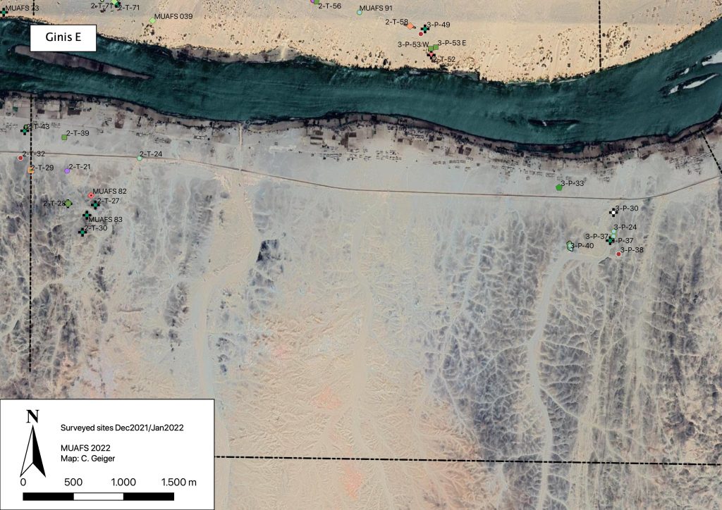
During our short season in December 2021/January 2022, we were able to record 14 sites on the East bank of the district of Ginis. These are 12 sites previously recorded by Vila as well as two new MUAFS sites (Fig. 1).
Fig. 1: Recorded sites in Ginis East, Dec. 2021/Jan. 2022. Map: C. Geiger.
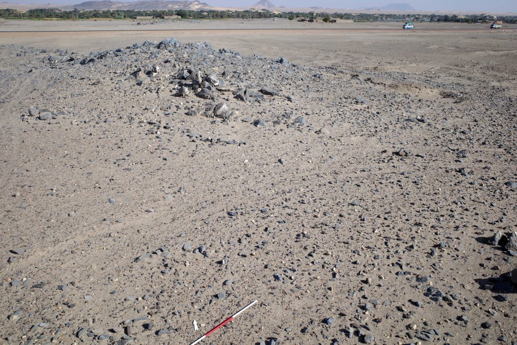
One particularly noteworthy site is the Abkan occupation site 2-T-21 at Ginis East, on a hill above the modern asphalt road (Fig. 2). According to the current chronologies, the Abkan period is dated to between c. 5500 and 3700 cal BCE (see D’Ercole 2021 with discussion and references).
Fig. 2: Overview of site 2-T-21. Photo: J. Budka.
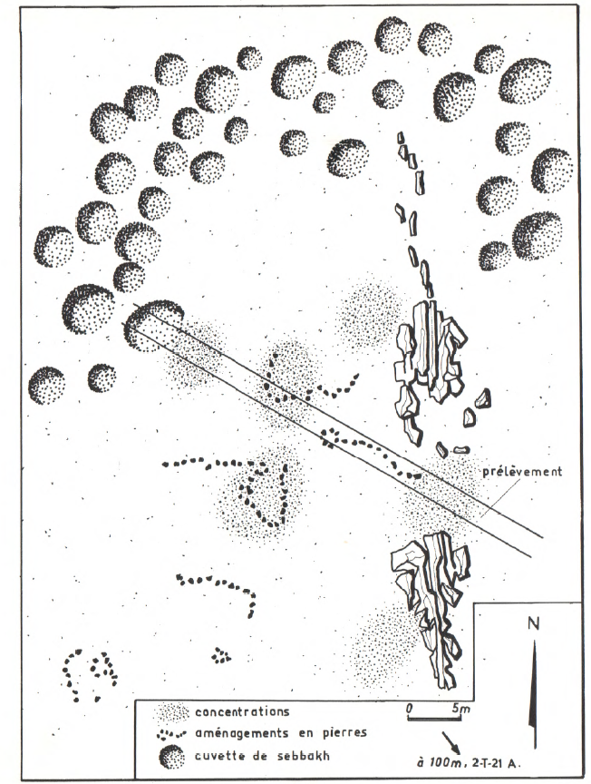
We could note that the meticulous documentation by Vila (1977) for 2-T-21 was correct (Fig. 3). Many diagnostic pottery sherds are still scattered on the surface. This site is clearly worth a more detailed investigation, although it has recently suffered from modern destruction like car tracks running through the site.
Vila’s sketch map of site 2-T-21 (Vila 1977, 60, Fig. 23).
Significant traces of Abkan occupation were recently documented by Elena Garcea on the island of Sai (Garcea 2020, 50 and 94 with references). The contemporaneous sites in our concession, of which several were documented on both riverbanks in Attab and Ginis, hold much potential and have received until now only little attention. Especially the relations of the Neolithic Abkan sites to Khartoum Variant sites in the region between the Dal Cataract and Sai Island needs to be explored in detail, not only regarding the chronology and possible overlaps but also in terms of subsistence strategies of these prehistoric communities as semi-sedentary hunter-gatherers and/or herding groups. This ties in with general questions about changes in the settlement strategies by Mesolithic groups compared to Neolithic communities (see D’Ercole 2021). Furthermore, until today, no cemeteries of the Abkan cultural complex have been identified – a highly unusual feature for a Neolithic culture in Sudan and something worth investigating in the future. Maybe the region between Attab and Ferka will provide some answers in this respect.
References
D’Ercole, G. 2021. Seventy Years of Pottery Studies in the Archaeology of Mesolithic and Neolithic Sudan. Afr Archaeol Rev 38, 345–372. https://doi.org/10.1007/s10437-021-09432-y
Garcea, E. 2020. The Prehistory of the Sudan. Springers Briefs in Archaeology. Cham.
Vila, A. 1977. La prospection archéologique de la Vallée du Nil, au Sud de la Cataracte de Dal (Nubie Soudanaise). Fascicule 5: Le district de Ginis, Est et Ouest. Paris.