
Back from the very successful International Conference for Meroitic Studies last week in Münster, I would like to elaborate on one interesting site I mentioned there in the broader context of Napatan sites in Ginis West. As outlined in a previous post, presenting these “stone villages”, I took another look at all our drone images and, above all, the georeferenced orthophotos and digital elevation models, especially from Attab West and Ginis West.
This enabled me to correctly locate a site in Attab West, on the border to Ginis West, which I had never found in the field in Sudan. This map of Ginis West was created by Kate Rose in 2023 after our last field season and shows all the Vila sites that we were unable to relocate in the field. There are various reasons for this – some of them are damaged, for some we have problems because of the georeferencing of Vila’s maps and because of unclear terrain on the ground.
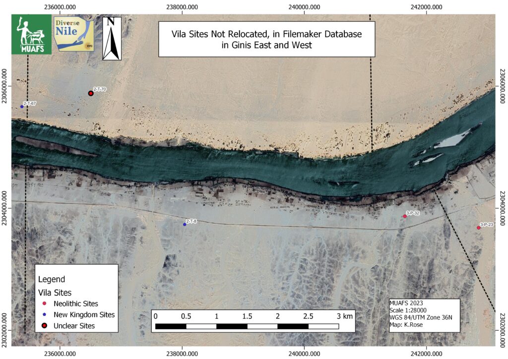
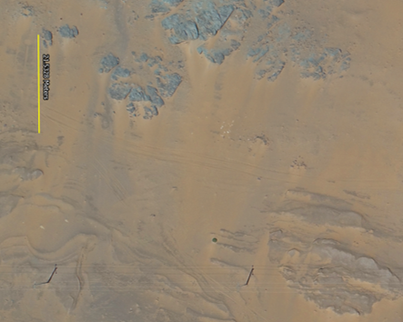
The latter holds true for Vila’s site 2-T-67 (Vila 1977, 93-96). I tried twice to relocate it on the ground, but could not find what Vila referred to as channels. I only saw sandy dunes, modern tracks, some depressions, but no clear traces of what Vila described. Since Vila dated these three openings with underground connections to channels to the New Kingdom, based on a single pottery vessel, the site was of greatest interest to DiverseNile. It was correspondingly annoying that I simply couldn’t find the site.
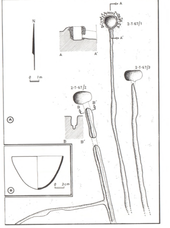
However, the dating of Vila is anything but certain. Looking at this pottery bowl, for example, it is more likely to date already from the Pre-Napatan period. The site is nevertheless truly intriguing – the basins and channels have recently been linked to post-flood irrigation by Mathew Dalton and colleagues (2023). They suggest very convincingly that the site, and in particular the circular features, one of which was surrounded by a stone setting, actually served as wellheads for shadufs. Now it was great when I discovered the channels and round depressions on the orthophoto based on our drone images from 2022!
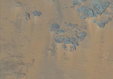
Importantly, our drone photographs show more features than those documented by Vila. Now that we have relocated this site, it will be possible to verify it in the field once we can go back to Sudan and try to obtain more certain dating evidence. This is particularly relevant to understand the dry stone walls in the area, the presumed irrigation systems (see Dalton et al. 2023) and the changing land- and riverscapes in Attab and Ginis.
References
Dalton et al. 2023 = Dalton, M., Spencer, N., Macklin, M. G., Woodward, J. C., & P. Ryan. “Three thousand years of river channel engineering in the Nile Valley.” Geoarchaeology, 2023, https://doi.org/10.1002/gea.21965.
Vila 1977 = Vila, A. La prospection archéologique de la Vallée du Nil, au Sud de la Cataracte de Dal (Nubie Soudanaise). Fascicule 6: District de Attab (Est et Ouest). Paris 1977.